

Michigan Tech monitoring buoy will enhance weather forecasting in the Straits of Mackinac
It was only a day after his Michigan Tech colleagues had deployed their new monitoring buoy in the Straits of Mackinac.
Already, Jamey Anderson was in his office in Houghton, Mich., using the buoy’s real-time data to watch a severe thunderstorm roll through the Straits.
“The air temperature dropped 12 degrees inside of five minutes. The wind speed picked up from six or seven miles an hour to 35. The wind direction was all over the place, just swirling, really violent. And the wave heights went from less than one foot to six feet . . . all in the span of about 10 or 12 minutes,” says Anderson, the co-ordinator of marine operations at Michigan Tech’s Great Lakes Research Center.
“Just imagine you’re in a little 12-foot boat, and you didn’t see this coming or get a marine warning,” he adds. “That would have put you in the water, for sure.”
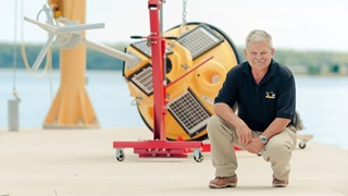
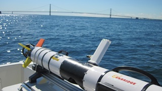
This environmental real-time monitoring buoy, which hit the water in the Straits on Aug. 18, is the fourth such buoy deployed by Michigan Tech in the Great Lakes.
Water-current information will benefit everyone using one of the most heavily travelled waterways in North America.
Even more significantly, this technological advance will also dramatically improve the accuracy of weather forecasting in the Straits – and the ability to issue public warnings – by agencies like the National Weather Service and the National Oceanic and Atmospheric Administration.
That means:
- More security and comfort for coastal marine traffic, which can face some of the most extreme weather in the Great Lakes – from severe thunderstorms to hail to violent wind gusts to snow squalls;
- Added safety for beachgoers near the Straits, where rip tides and rip currents are an ever-present danger.
“Recreational boaters in a small craft can find themselves in trouble with a simple change of wind direction. The real-time observations provided by this Michigan Tech buoy will be invaluable for the countless commercial and recreational vessels that use the Straits, and may also allow for more timely warnings or alerts to the public,” says Jim Keysor, a warning co-ordination meteorologist with the National Weather Service in Gaylord, Mich.
In the very near future, information collected by the Straits buoy will be available to the public through Michigan Tech’s Upper Great Lakes Observing System website, with updates every 10 minutes.
“What’s critically important about these Michigan Tech buoys, like the one in the Straits,” remarks Anderson, “is that they report via cellular every 10 minutes. All the large federal buoys report via satellite every hour. For a lot of these violent phenomena that will come through the Great Lakes, an hour is not quick enough to react, quantify, and issue warnings or alerts to the public.”
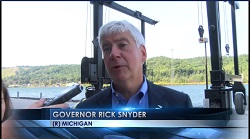
Enbridge has sponsored the operation of this Straits of Mackinac buoy for the next two years. Our Line 5, which runs under the Straits of Mackinac, carries natural gas liquids (NGLs), including propane, as well as light crude oil – heating homes and businesses, fueling vehicles, and powering industry in Michigan.
The Straits of Mackinac are a special place, and that's why we take special precautions to ensure the safe and reliable operation of Line 5 as it crosses under the Straits. Partnering with Michigan Tech to deploy this monitoring buoy provides one more layer of safety and protection in the region.
“Having these coastal buoys in the Great Lakes, consistently reporting data on waves and currents, transforms weather forecasting into a truly useful service for the entire region,” says Anderson.


